10K Trail South from the Crest Highway

If you chose to hike south instead of north along the 10K Trail, you’ll find a similarly cool, shady trail; for a video preview, click here. South of the Crest Highway, the trail has more open areas as well as more pronounced ups and downs. The area includes mountain bike trails and other paths that could lead you astray. If you have cross-country navigation skills, being “led astray” can be fun—but here I’ll provide the information you need to stay on the actual 10K Trail. As you hike it, keep an eye out for small blue diamonds high on trees. If you see one, you're probably on the correct path.
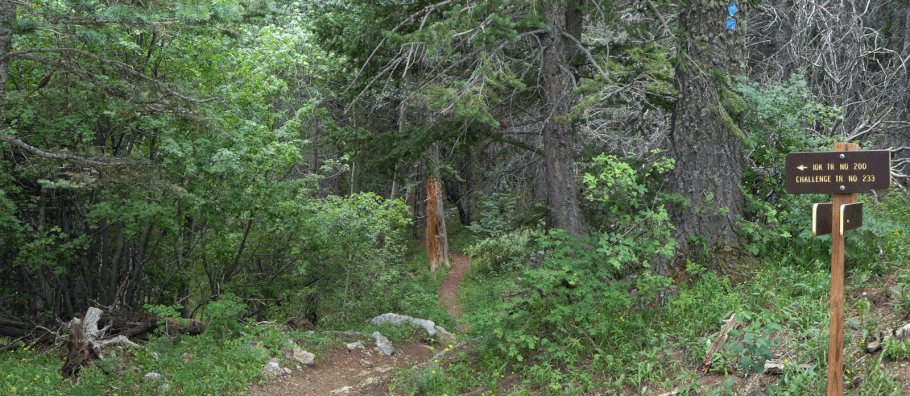
To reach the trailhead from Albuquerque, drive east on I-40. Take the Tijeras/Cedar Crest exit and head north on NM 14. Turn left (west) on the Sandia Crest Highway (NM 536) and head up the mountain. At 35 deg. 12.562 min. N, 106 deg. 26.122 min. W, turn left into a strip parking lot (a fee area, with pit toilets across the highway). At the downhill (southeast) end of the lot, the combined 10K-Challenge Trail heads into the woods and down slope, paralleling the Crest Highway. At 35 deg. 12.355 min. N, 106 deg. 25.931 min. W, you’ll see the trail sign shown below. At that location the Challenge Trail (No. 233) continues downward while the 10K Trail (No. 200) turns to the right (southeast) and follows a more level course.
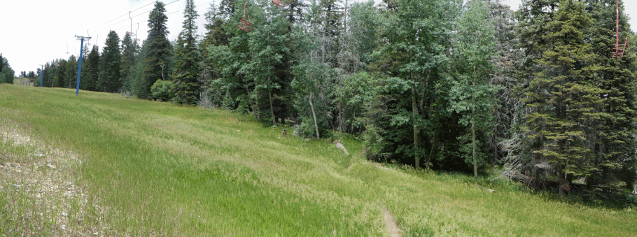
Roughly a mile in, the 10K trail crosses the first of several ski runs. Because of the mountain bike trails, it’s easy to get distracted. At the risk of overdoing it, I’ll provide multiple waypoints to get you through the ski area. Each waypoint indicates where the southbound trail finishes crossing a ski run and reenters the woods.
- 35 deg. 12.079 min. N, 106 deg. 25.802 min. W
- 35 deg. 12.015 min. N, 106 deg. 25.778 min. W
- 35 deg. 12.011 min. N, 106 deg. 25.702 min. W
- 35 deg. 11.943 min. N, 106 deg. 25.676 min. W
- 35 deg. 11.902 min. N, 106 deg. 25.654 min. W
- 35 deg. 11.840 min. N, 106 deg. 25.604 min. W
- 35 deg. 11.772 min. N, 106 deg. 25.533 min. W
If you just upload just two or three of these waypoints, be sure to include the last one. That’s where the trail leaves the final ski run and continues into the woods.
Once past the ski area, following the trail is straightforward. At 35 deg. 11.235 min. N, 106 deg. 25.248 min. N you’ll encounter a short section of fence marking the junction of the 10K, Crest, and Tree Spring Trails. A short distance uphill is the crest of the Sandias and a view of Albuquerque—a good place to stop for lunch before retracing your steps. See my page on the Tree Spring Trail for details.