10K Trail north from the Crest Highway

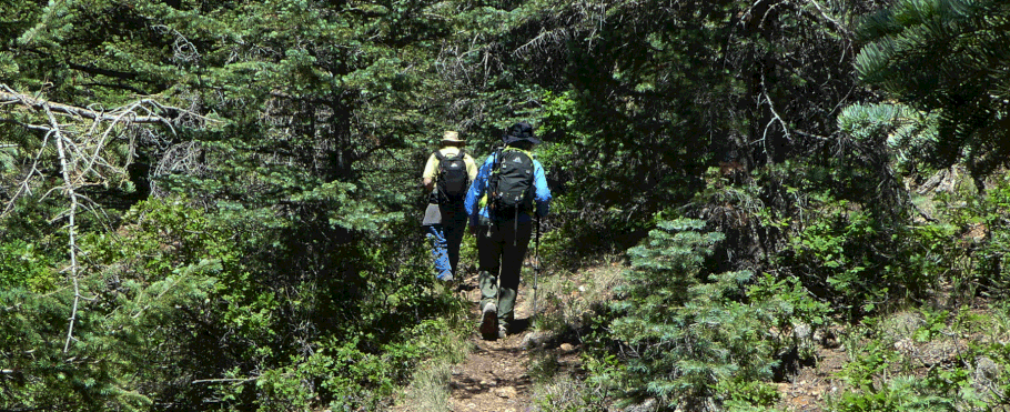
The name “10K” refers to the fact that this trail roughly follows the 10,000 foot contour in the Sandia Mountains. In late June 2019 we hiked the segment extending north from the Crest Highway, and found it to be cool, shady, spangled with wildflowers, and mostly not rocky. The trail is obvious and actively maintained. It wanders up and down as well as sideways, providing some exercise with your ramble. If you opt to hike the 10K Trail southward instead, you'll find the hiking directions here.
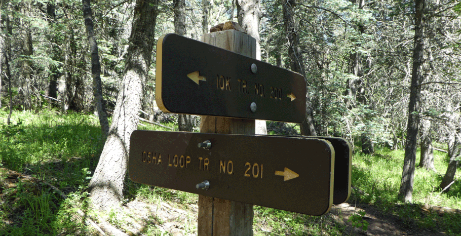
To reach the trailhead from Albuquerque, drive east on I-40. Take the Tijeras/Cedar Crest exit and head north on NM 14. Turn left (west) on the Sandia Crest Highway (NM 536) and head up the mountain. At 35 deg. 12.562 min. N, 106 deg. 26.122 min. W, turn right into the parking lot (a fee area with pit toilets). The 10K trail (No. 200) heads north from the far end of the parking lot.
If your goal is a short in-and-out hike, a couple of knolls along the trail make for pleasant stopping points. About two miles in, at 35 deg. 13.957 min. N, 106 deg. 26.654 min. W, the 10K trail meets the south end of the Osha Loop Trail (No. 201), in Media Canyon.
From here you have multiple options for extending the hike.
- If you take a left turn at the junction, you’ll follow the 10K trail up Media Canyon. The trail joins the Crest Trail at the overlook for upper Del Agua Canyon (a popular spot for viewing aspens in the fall). This last segment of the 10K trail involves a 350 foot gain over perhaps two-thirds a mile. Between the junction and the Crest Trail, the 10K trail crosses the Ellis and Survey Trails, so it’s possible to create an open-ended loop hike where you take the 10K trail north and the Crest, Survey, or Ellis Trail south (or vice versa). If so, you’ll probably want to leave a second car at your destination trailhead.
- If you take a right run at the junction, you can follow the Osha Loop Trail as it drops to the northeast, then climbs westward to the crest of the ridge. You can then take the Ellis, Survey, or Crest Trail southward to the 10K trail and drop down to the junction of the 10K and Osha Loop Trails, for a “lasso” or “lollipop” route (loop at the end of an in-and-out).
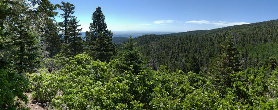
We opted to do an easy in-and-out by following the Osha Loop Trail northeast a short distance. Almost as soon as you step onto the Osha Loop Trail, you enter the local wilderness area. As you leave Media Canyon, you’ll have a brief but impressive view to the south and southeast. We hiked a bit further and found a bench-sized log in the shade to eat lunch, before returning the way we came.
About 200 meters from the 10K-Osha Loop junction is the marked location of Media Spring. If you want to visit that location, follow the Osha Loop Trail about 60 meters from the junction, to 35 deg. 13.990 min. N, 106 deg. 26.635 min. W. Turn right off the trail and look for a sketchy route (not a formal trail) that drops down canyon while staying slightly to the left (north side) of the canyon bottom. When we visited the location of the spring in late June 2019, the old wildlife drinker was dry as a bone. The ground in the canyon bottom wasn’t damp, despite how wet the previous winter and spring had been. Apparently Media Spring no longer exists.
