North Crest Trail, North Sandia Peak, and Survey Trail
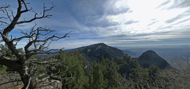
North of the Sandia Crest parking area, the Crest Trail provides hike options with great views. To reach the trailhead, take NM 536 to the crest of the Sandia Mountains and park in the large parking lot (a fee area) at 35 deg. 12.662 min. N, 106 deg. 26.962 min. W. The northern portion of the Crest Trail begins just north of this spot; as you head north, keep right (east) of the fenced area for the electronics towers. Continue past the towers. Side trails, a few yards long, take you from the main trail to overlooks.
For a particularly nice viewpoint, turn left off the Crest Trail about 35 deg. 13.476 min. N, 106 deg. 27.127 min. W, then follow an unmaintained but fairly obvious ridgeline path northward. You'll soon find yourself on a high point where the view includes the Needle to the WNW and North Sandia Peak to the north. Afterwards, continue along the path as the ridgeline drops to the northeast. About 35 degrees 13.643 min. N, 106 deg. 27.121 min. W, you'll rejoin the Crest Trail. If you turn right (south), you'll be back at your car after a round trip of 2 1/2 miles or so. For a longer hike, turn left (north).

To visit North Sandia Peak, turn left off the Crest Trail at 35 deg. 13.795 min. N, 106 deg. 27.140 min. W and follow an informal path that leads roughly northward, near the dropoff. The peak is at 35 deg. 14.108 min. N, 106 deg. 27.401 min. W and is marked by the foundations for a navigation beacon. You can find more remains of the beacon a few meters down the east slope of the peak, under fallen trees. The beacon was used during Army Air Forces training during the Second World War. After visiting the peak, retrace your steps to the main trail.
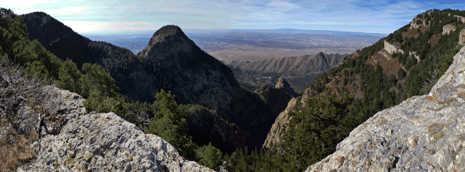
Whether or not you visit North Sandia Peak, you can make a longer hike of it by continuing north on the Crest Trail. As it bypasses North Sandia Peak, the Crest Trail drops toward the intersection with the 10K Trail, which is at 35 deg. 14.257 min. N, 106 deg. 26.984 min. W. Continue a few meters beyond the intersection to an overlook of Del Agua Canyon. The slopes below the overlook are dominated by aspens, so the overlook is a great fall hiking destination.
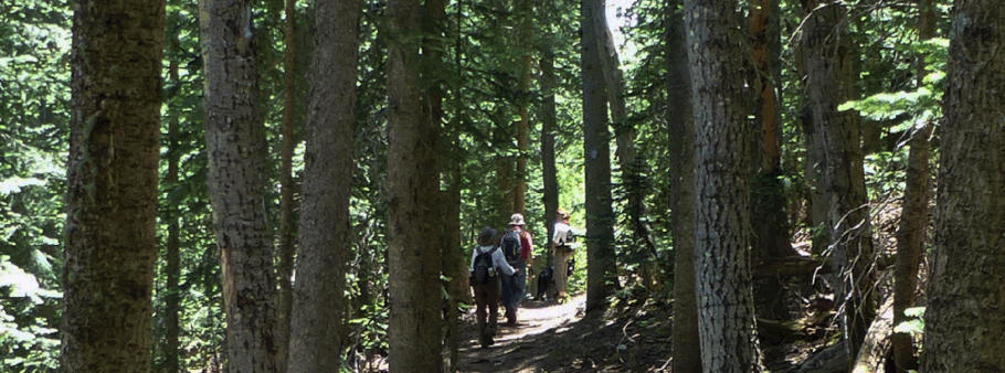
From the overlook you can retrace your steps along the Crest Trail, but here's another option. Once back at the intersection with the 10K trail, follow that trail down into the woods. About 200 meters along the trail (as the crow flies), the 10K trail intersects the Survey Trail, at 35 deg. 14.158 min. N, 106 deg. 26.939 min. W. Take the right fork, which puts you on the Survey Trail. Follow that trail southward, mostly through shade.
The problem with this loop hike is the need to climb from the Survey Trail back to the Crest Trail to complete the loop. The longer and more pleasant option is to follow the Survey Trail across the Crest Highway and then work your way up to the Crest via the local trail system.
The shorter, steeper, sun-baked option is to follow a power line from the Survey Trail up to the Crest. To use the latter option, turn uphill at 35 deg. 12.998 min. N, 106 deg. 26.866 min. W, where the Survey Trail passes under the power line. Bushwhack up the power line until you encounter a hairpin turn in NM 536. After scrambling up the embankment, cross the lower arm of the turn, angle left, and follow the two-track that angles right to the upper arm of the turn. Cross the upper arm of the turn, angle left, and continue uphill until you encounter the Crest Trail. Turn left (south) and follow the Crest Trail back to the parking lot.
To make an even longer hike of it, stay on the Survey Trail and follow it southward to its intersection with NM 536, at 35 deg. 12.612 min. N, 106 deg. 26.682 min. W. Cross the road and use the “delightful mess of trails” south of the highway to zigzag back up to the Sandia Crest parking lot.
