Pino Trail in the Sandia Mountains

The Pino Trail begins at an Albuquerque city park and is highly popular among Burqueños, including for serious or casual hiking, trail running, or excursions with Fido. The trail is wide and obvious and the elevation gains are mostly moderate. The trail includes one of my favorite types of hiking destination, a shady spring, but only seasonally.
Access the trailhead via Simms Park Road, which heads east from Tramway between Academy and Paseo del Norte. Stop at the park entry station and pay the user fee ($1.00 weekdays, $2.00 weekends; bring the exact amount in cash). The parking area facilities include pit toilets. There are two trailheads, actually. If you park in the first paved area after the entry station, start at 35 deg. 9.719 min. N, 106 deg. 28.179 min. W. If you park at the second paved area, start at 35 deg. 9.796 min. N, 106 deg. 28.211 min. W. The two trailheads are about 50 meters apart, so it's no big deal which one you use.
Once you start you'll encounter a possibly confusing network of trails, but also trail signs. The main thing is to head toward the canyon in front of you. The routes from the two trailheads converge at a granite memorial bench at 35 deg. 9.858 min. N, 106 deg. 27.823 min. W. The Pino Trail crosses the Foothills Trail and enters the Sandia Mountain Wilderness at 35 deg. 9.903 min. N, 106 deg. 27.413 min. W.

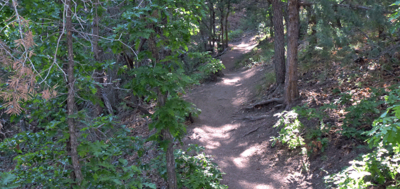
As the photo just above indicates, the trail starts in rolling juniper-dotted grasslands (at 6460 feet), and can be quite warm in the summer months. Once you reach the wilderness area, you'll encounter a lot of shade. If you're looking for a short hike and a picnic, there are multiple spots where a small group can step off the trail. For a larger group, your best bet for a lunch stop may be at 35 deg. 10.048 min. N, 106 deg. 26.185 min. W.
Higher up the amount of shade decreases, due to an extensive die-off of Ponderosa pines. The former underbrush is taking over and is crowding this section of the trail. You'll repeatedly brush against the new growth, exposing yourself to ticks, so it's a good place to wear long pants and socks treated with tick repellent.
Pino Spring (35 deg. 10.105 min. N, 106 deg. 25.495 min. W) can be a good destination for a moderate hike, but it's unreliable. Your best bet for finding water at there may be the spring months, when snowmelt feeds canyon-bottom trickles in various parts of the Sandias. In late May 2016 you'd have been able to harvest plenty of water, if you had a way to purify it. The spring is in a narrow canyon bottom so not a great lunch spot.
The trail continues all the way to the top of the mountains, joining the Crest Trail, but beyond Pino Spring the trail becomes much steeper. From Pino Spring to the Crest Trail it's only 0.6 mile (1 km) as the crow flies, but a 1200 foot elevation gain. A fit hiker will be able to complete the entire 8 mile trail, with a lunch stop at the crest, but weekend ramblers will want to turn around before the final section.
