Mesa Portales from the South

For those who enjoy hiking New Mexico's high desert, Mesa Portales is a little-known gem. The mesa is mostly BLM land so is not affected by Forest Service fire closures. There is some private land, but not along this hike.
The hike uses the Continental Divide Trail to reach the mesa top, then goes goes off in other directions. (The Google Earth route for access from the south, as shown on the "Roads" layer, is wildly inaccurate.) A hiking pole or two will come in handy during the ascent and descent of the mesa.
From US 550 between San Ysidro and Cuba, turn west at 35 deg. 52.670 min. N, 106 deg. 58.361 min. W. You will be on a graded dirt road that wanders westward up a drainage, then straightens out. (The local roads turn to muck when wet, so the hike should not be attempted after heavy rain or snow.) At 35 deg. 52.212 min. N, 107 deg. 1.889 min. W the Continental Divde Trail (CDT) crosses the road. Right after the marker you can turn off the road to the north (right) and park.
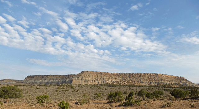
Begin hiking toward Mesa Portales, northwest along the CDT, which begins as a straight path with marker posts. The trail enters and meanders through a wooded area; from this point onward the marker posts are replaced by cairns. The trail reaches the base of the mesa and turns NNE, passing between the side of the mesa and outlying knolls. Erosion of the shale beds has created a narrow strip of badlands.
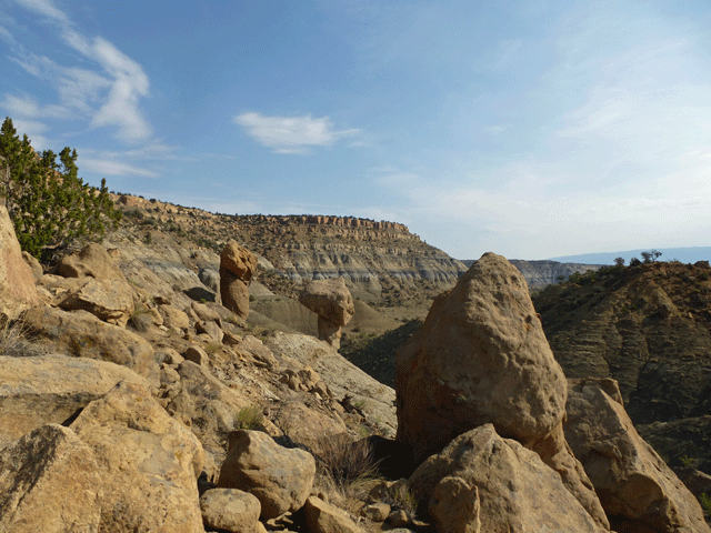
At 35 deg. 53.529 min. N, 107 deg. 2.184 min. W, the trail turns west to zigzag up rockfall that has covered the soft shale, creating a passable slope. Between upward zigzags the trail trends northwest, topping out at 35 deg. 53.633 min. N, 107 deg. 2.346 min. W.
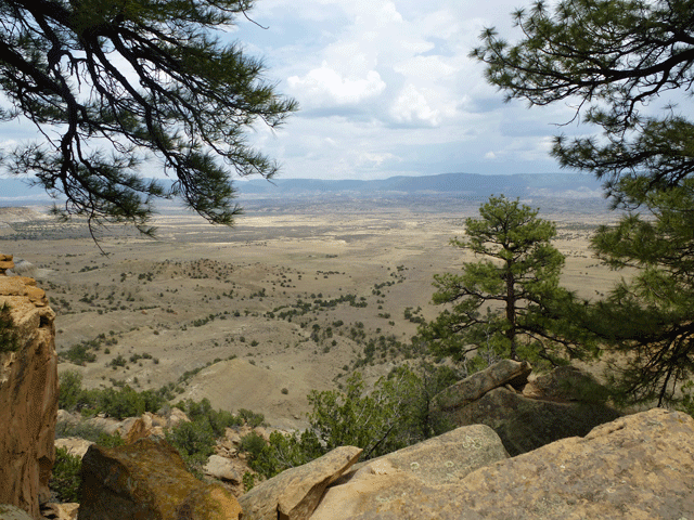
From the mesa rim the trail heads about 60 meters west and joins a "two-track" dirt road that parallels the rim of the canyon. The CDT turns north and follows this two-track, but the day's hike now leaves the CDT and turns south to follow the two-track in the opposite direction. Follow this two-track to within 100 meters of 35 deg. 53.147 min. N, 107 deg. 2.688 min. W, then cut south through the trees to enjoy the view from the mesa's high point.
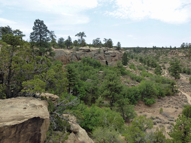
Now it's time to explore the interior of the mesa. Head northeast through sagebrush to 35 deg. 53.403 min. N, 107 deg. 2.606 min. W, where two two-tracks join. From there head north into a wooded shallow drainage until you strike the dry stream bed. Follow the stream bed downstream, north and west, until you encounter a canyon head. To your right, at 35 deg. 53.565 min. N, 107 deg. 2.765 min. W, is an old road cut that takes you safely down into the canyon. The road cut connects to an old two-track that heads down the canyon, swinging out of the bottom in places to avoid the worst parts of the dry stream course.
At 35 deg. 53.959 min. N, 107 deg. 3.064 min. W, in an alcove in the northeast wall of the canyon, is a spring. You can reach it easily by leaving the two-track and crossing the dry stream
bed. Cattle have trampled the spring within the alcove but slightly below the alcove there was (July 2013) a clear pool in the rocks, with enough water for a small hiking party to use overnight.
(As for all water in the region, purify before using.) (A fellow hiker has informed me that as of early 2022, this spring is dry.)
If you have time you can continue exploring the canyon, but a route out of the canyon is close by. If you choose this option, head to the slope northwest of the spring, towards 35 deg. 53.977 min. N, 107 deg. 3.098 min. W, and you will encounter the (easy to overlook) remnants of an old, washed-out pack trail from the canyon bottom to the rim. Follow this old route northeast, angling up the slope, until you top out at 35 deg. 53.983 min. N, 107 deg. 3.085 min. W. From there, head east and you will encounter a two-track that borders an expanse of sagebrush. These are the same "sage flats" you encountered just after reaching the top of the mesa, and it's possible to pick a variety of routes back to that point. You can cut directly across the sage, for example, or you can follow the two-track southward for a while before turning east. The main thing is to have the coordinates for where the CDT tops the mesa, so you can follow that route back down.
- If you choose to explore farther down the canyon, here's a fun way to get back on top of the mesa. Follow the two-track downstream until you're opposite 35 deg. 54.189 min. N, 107 deg. 3.275 min. W. Clamber up to that waypoint, which is at the base of a cliff. To your left you'll see a cleft in the cliff that you can follow to the top of the mesa.
- If you explore even farther down the canyon, there's "last chance" route back to the top of the mesa (on the correct side of the canyon for this hike). Follow the two-track down the canyon until you're opposite 35 deg. 54.238 min. N, 107 deg. 3.471 min. W. Cut over to that spot and you'll find yourself on an abandoned wagon road that heads NNE to the head of an alcove. At 35 deg. 54.344 deg. N, 107 deg. 3.422 min. W, you'll arrive at the base of a wagon road ramp that heads upward and to your left (southwest), to the top of the mesa.
If you exercise either option for extending your hike down Cañon Jarido, navigate east and south on the mesa top in order to return to the point where the CDT tops out on Mesa Portales, completing the loop portion of the hike. OTOH, if you do take the cleft or "last chance" route out of the canyon, the canyon head for Cañada Lucero will be less than a mile to the NNE. You could connect with the hike described here, to create a through hike of Mesa Portales.
During the hike you may encounter artifacts and other traces of prehistoric or historical human activity. These are protected by law, so take nothing but pictures and memories.