TWA Canyon in the Sandia Mountains
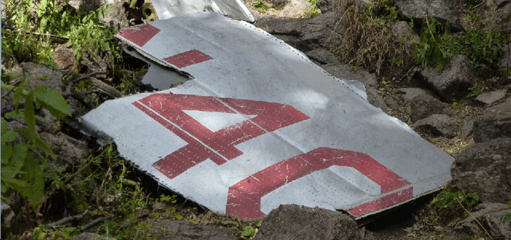
This hike is more difficult than its length (7 1/2 miles round trip) suggests. The upper part of the hike is steep and involves scrambling over ledges. Hiking poles are a good idea. The destination is a sad place—the remnants of a passenger plane that crashed into the mountainside on February 19, 1955, killing all 16 persons aboard. TWA Flight 260 took off from Albuquerque Airport in snowstorm and the electronic compass apparently malfunctioned, causing the pilot to fly in the wrong direction.
In Albuquerque, take Simms Park Road east from Tramway; this intersection is just north of Tramway and Academy. Stop and pay the car fee ($1 weekdays, $2 weekends) and turn right onto the loop road. Pass the first parking spaces, instead turning left (north) and parking at 35 deg. 9.796 min. N, 106 deg. 28.211 min. W (elev. 6470 feet).
Start hiking east to 35 deg. 9.857 min. N, 106 deg. 27.954 min. W, where you turn left (north) and cross an arroyo. Continue roughly north, then turn right (east) at the T intersection at 35 deg. 10.091 min. N, 106 deg. 28.099 min. W. This path curves northward, to the Domingo Baca trailhead at 35 deg. 10.262 min. N, 106 deg. 28.011 min. W.
Take the Domingo Baca trail (right fork) and head northward, skirting the base of the mountains., to 35 deg. 10.520 min. N, 106 deg. 28.117 min. W, where you turn upstream into the canyon. At 35 deg. 10.805 min. N, 106 deg. 27.718 min. W you will encounter the remains of a stone cabin. Drop into the stream bed and follow the stream bed upstream, ignoring the trail on the north side of the stream.
At 35 deg. 10.886 min. N, 106 deg. 27.594 min. W it’s time to climb out of the stream bed, toward the east. There is now a post at the turn, as I show in the photo below.
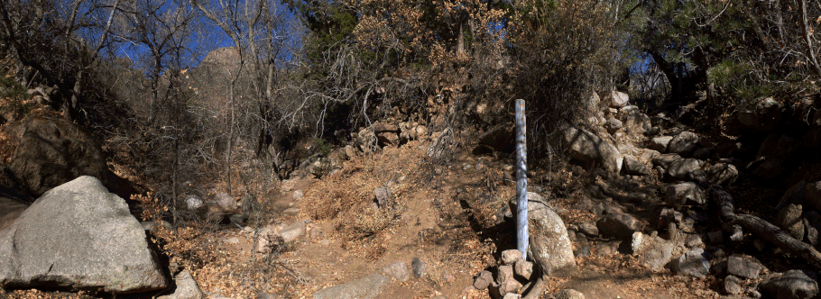
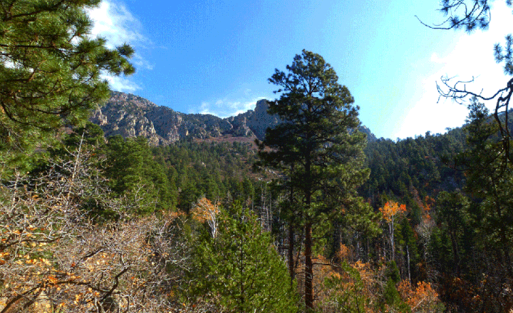
The photo is a panorama and when you're out there, you need to turn to take it all in! Start with the left half of the panorama. The stream bed continues past the turnoff, between the triangular boulder and the post. When you reach this spot, turn 90 degrees right and look for a break in the little bluff to your right (at the right edge of the photo, and just to the right of the post). Head up the break. You will find yourself on an obvious path heading up the side canyon. Follow the unofficial but obvious trail through a lovely part of the Sandia Mountains.
Towards the end of the hike the trail gets steeper and more difficult. You will reach the crash site at 35 deg. 11.696 min. N, 106 deg. 26.552 min. W (elev. 8730 feet). Additional debris from the crash is present higher in the ravine.
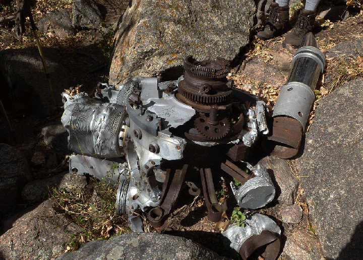
Please treat the crash site with the reverence it deserves.