Sandia Foothills near La Madera
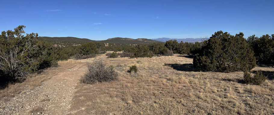
So you’ve been hiking the Sandias for years, and it feels like you've run out of new places to try. Here’s a corner of the local national forest that even you may have overlooked. There are no maintained trails or helpful signs, just a half-dozen square miles that you’ll have all to yourself. Because the area is undeveloped and seldom used, it’s not for beginners. Instead it’s a place for experienced hikers who don’t mind no-guarantees places, and who know how to get themselves out of trouble as needed. A hiking pole or two will come in handy when the chosen route gets steep and rocky.
The key to exploring this area is the national forest access point at 35 deg. 15.062 min. N, 106 deg. 21.694 min. W. Most of the drive to that point follows the same route as for Golden Open Space. From Albuquerque, head up Tijeras Canyon on eastbound I-40, then north on NM 14 (the Turquoise Trail). Once past the traffic circle where NM 536 (the Crest Highway) turns off, continue north about a mile, past the local elementary school, and turn left (roughly west) onto La Madera Road. You’ll quickly pass the Vista Grande Community Center and the local high school.
About 0.7 mile from NM 14, La Madera road turns roughly north. Here the road is very curvy and lacks shoulders. Also, some local drivers don’t believe in speed limits. In other words, a good place to drive cautiously. Eventually you’ll enter the scattered rural bedroom community of La Madera. By keeping to what looks like the main road, and by paying attention to street signs, you’ll be able to follow La Madera Road to the turnoff you need. That’s Calle Mañana, an unpaved but graded road that starts at 35 deg. 14.534 min. N, 106 deg. 21.395 min. W (or just look for the street sign). Turn left and head NNW until Calle Mañana ends at the forest access point (at the intersection with Stagecoach and Piñon Roads).
(On the return drive, at the intersection of Calle Mañana and La Madera Road, it’s difficult to see vehicles heading south along La Madera. Be careful when pulling onto the pavement. Or turn right onto Sierra Vista just before the southeast end of Calle Mañana, and you’ll wind up at an intersection with better lines of sight.)
All that blather, just to get you to a point where you can park your car and start walking. So where to walk? It helps to know that the starting point is at a pipeline that heads northwest to Placitas. I suppose you could follow the pipeline scar all the way there, if you were so inclined—but if there’s public access to the pipeline from that end, I haven’t found it. Instead, I recommend that you use Google Earth or a similar app to make note of your options, and learn the area by exploring. Here I’ll mention three possibilities, for which I make no promises.
About 50 meters in from the forest boundary, a two-track heads off to the right and wanders some distance, dwindling into a path on a ridgeline.
About 225 meters in, a two-track heads off to the left and descends into the local valley. Once you’re in the valley bottom, you can explore from there.
About 325 meters in, shortly before the pipeline drops into the local valley, a funky little path heads off to the right and heads down the local ridgeline.
And so on. I’m sure you get the idea. Good luck and good rambling.
