San Lorenzo Canyon
For a brief YouTube preview of this hike, click here.
By local standards a low elevation hike (between 5100 and 5500 feet) so a good fall through spring hike. The dirt access roads are mostly sandy and gravelly and should still be passable after recent rains. If you're experienced with driving off paved roads, you shouldn't have any problems (if not, let someone else drive). Do not attempt this hike when flash floods are possible, as the hikes and part of the access route follow stream beds.
Driving south from Albuquerque, exit I-25 at the San Acacia exit (Exit 163), turn left to cross over the freeway, set your trip meter to zero, and head south on the east frontage road. About 2.2 miles south of the exit, just after crossing a wide wash, pass through the one-car wide underpass (the second one you'll encounter) to the west side of I-25. Where the paved road curves sharp left (south) to become the west frontage road, continue straight onto the dirt road. (You can reach this same point by exiting at Lemitar and taking the west frontage road north about 4.6 miles).
Follow the main dirt road west and a bit north, paralleling the large wash. At 34 deg. 13.602 min. N, 106 deg. 57.301 min. W, turn right and drop into the wash. Continue up the wash bottom, heading WNW, until the mouth of the canyon. Park somewhere near the mouth, no more upstream than roughly N 34 deg. 14.651 min. N, 106 deg. 59.250 min. W, off to one side. (You could park farther up the canyon, but why cheat yourself of a lovely walk?)
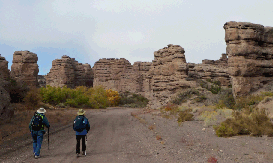
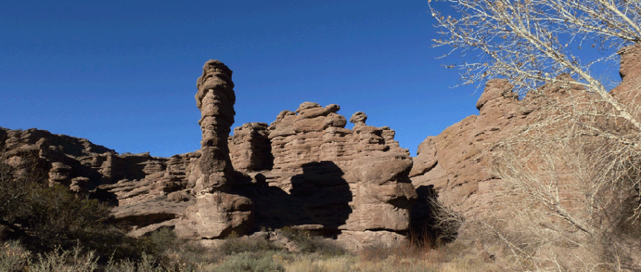
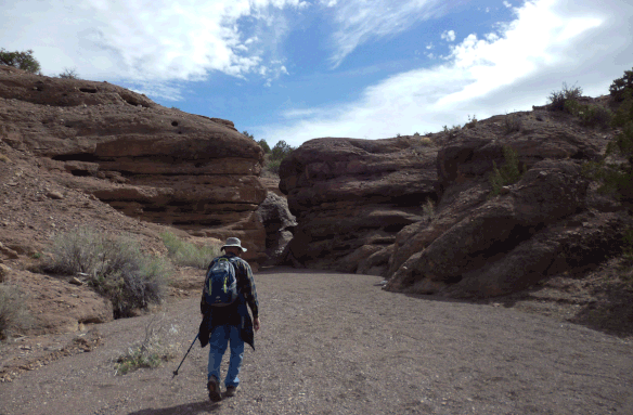
Once parked, hike up the canyon bottom. You will encounter a succession of sculpted canyon walls and slots barely wider than you are. Sevilleta National Wildlife Refuge is on the north side of the canyon and is closed to the public, but the land south of the canyon is managed by the Bureau of Land Management (BLM) and yours to explore. At 34 deg. 14.398 min. N, 107 deg. 0.387 min. W you will encounter a ledge where all wheeled vehicles must turn around, but hikers can scramble up the ledge. The best spot to do this is to the right.
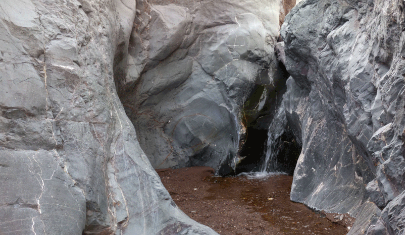
At 34 deg. 14.348 min. N, 107 deg. 1.163 min. W, you will encounter a small waterfall in a slot canyon. Rock climbers and other gymnastic types will think nothing of the obstacle, but you can make this your turnaround point: not far beyond this point, the canyon ends and the local landscape becomes far more ordinary.
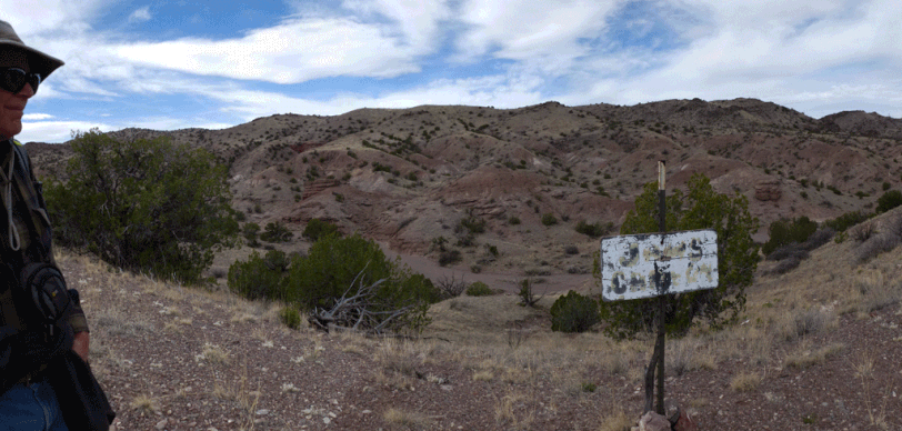
There are at least two easy ways to exit the canyon in order to explore the dissected, juniper-dotted country to the south. Here I'll combine them into a single side trip.
At 34 deg. 14.152 min. N, 107 deg. 0.626 min. W, look to south and you'll see a wire fence. Pass through the wire gate in the fence and turn right, up the slickrock, and follow the two-track out of the canyon. Once on the ridgeline, follow the path that branches right (southwest) into the adjacent shallow drainage. Walk up the sandy stream bed. About 180 meters later, follow the old two-track angling right, onto the ridge to the west. You'll top out at 34 deg. 13.998 min. N, 107 deg. 0.701 min. W. Turn right (north) on the two-track that follows the ridgeline back toward San Lorenzo Canyon.
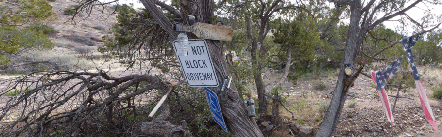
About 40 meters north of where you reached the ridgeline, an eroding two-track drops into "Jaws Canyon." Follow the two-track to the bottom, then turn left (south) and walk up the sandy stream bed. About 150 meters upstream you'll encounter a memorial for Victor "Jaws" Bustamante. Why out here? Perhaps this was his favorite place for getting away from it all. When I first saw this monument in 2017 it was fairly elaborate, but it's slowly disappearing.
If you continue up the sandy stream bed, at 34 deg. 13.791 min. N, 107 deg. 0.687 min W you'll find the perfect lunch spot. Here the stream has cut an alcove into the bedrock. The floor of the alcove is sandy and out of the wind; you can sit in or out of the sun as the weather demands.
After lunch, head back down the stream bed all the way to San Lorenzo Canyon proper, rejoining it at 34 deg. 14.191 min. N, 107 deg. 0.687 min. W.