Salas Cabin via the Salas Trail

The Salas Trail, in the western foothills of the Manzano Mountains, is best done in the fall through spring months. On the whole it’s a gentle hike that follows an obvious path, staying low while providing views of the Rio Grande Valley. The local geology is dominated by schist, which makes for an interesting change from the granite of the western Sandias. The trail includes many small ups and downs, which you probably won’t notice much until the return portion of the hike. From the parking area to Salas Cabin and back, the hike is about 7 miles.
The trail begins at the Forest Service’s long-defunct JFK Campground. I describe how get there on a separate page. To begin the hike, leave the parking area and follow the gated-off road SSE into the closed campground. The road becomes a loop, then continues up canyon at the far end of the loop.
The sign marking the start of the Salas Trail is at 34 deg. 40.207 min. N, 106 deg. 27.932 min. W, to the right of a pipe fence and gate. Apparently most people save a few steps by leaving the campground before that trailhead and bushwhacking south until they intercept the trail. If you take this shortcut, take the right-hand road when you get to the loop and don’t turn off the road until you pass the obvious gate onto private land. Also, stay east of the boundary fence for the National Forest as you bushwhack south.
However you choose to begin, there seems to be no obvious path at first. Instead, get yourself to 34 deg. 40.130 min. N, 106 deg. 28.150 min. W, near where the National Forest boundary fence zags from south to southwest. From this point on you should see a well-used path. If you’re on the correct route, at 34 deg. 40.013 min. N, 106 deg. 28.278 min. W you’ll pass over a small saddle.
Continue generally SSW, until you reach a prominent saddle at 34 deg. 39.126 min. N, 106 deg. 29.016 min. W. Here the trail drops into Cañon de Salas, crosses the arroyo, passes a collapsed shack, and heads more or less west, away from the mountains. On reaching the National Forest boundary fence, the trail turns southwest. Keep an eye out for a fin of white rock, which is a massive vein of quartz. The trail will take you past the west side of this outcropping and around its south end, to a one-room stone cabin at 34 deg. 38.691 min. N, 106 deg. 29.717 min. W.

Salas Cabin is an impressive example of stonework, but the roof is collapsing. It might be a good place to huddle during a blizzard, but I wouldn’t sleep there. The porch roof is more intact, providing shade as you eat lunch. If you explore the rock outcrop next to the cabin, you’ll find a shelter at the south end that should keep you dry during a (lightning-free) rainstorm. You’ll also find a ventana (window) at the north end. Behind the cabin is a stone outhouse built for the ages—but if I had built it, I’d have faced the door towards the Manzanos, to provide scenery to go with the experience.
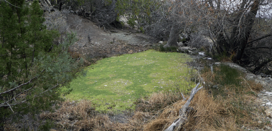
About two hundred meters south and a little east of the cabin is Salas Spring, which appears to be a reliable source of water (but don’t bet your life on that). The spring itself is a scummy pool but just below it are a couple of troughs where it’s easier to obtain water. As always in the Southwest, purify any water you harvest in the wild.
Once you are done with your visit to Salas Cabin and Salas Spring, retrace your steps to complete the hike.
