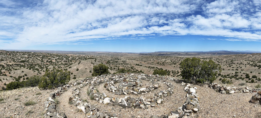
The Sacred Spiral in the Placitas Open Space
The Placitas Open Space is crisscrossed by trails, so you can wander almost at will. It’s a 560 acre patch of mostly gently rolling high desert, owned by the City of Albuquerque. Here I’ll introduce you to the area through an easy ramble, just 2 1/2 miles. The parking spot is at 5340 feet, and the Sacred Spiral (the goal of the hike) is at 5610 feet. This is a hike best saved for not-too-hot, not-too-breezy days in the fall through the spring.
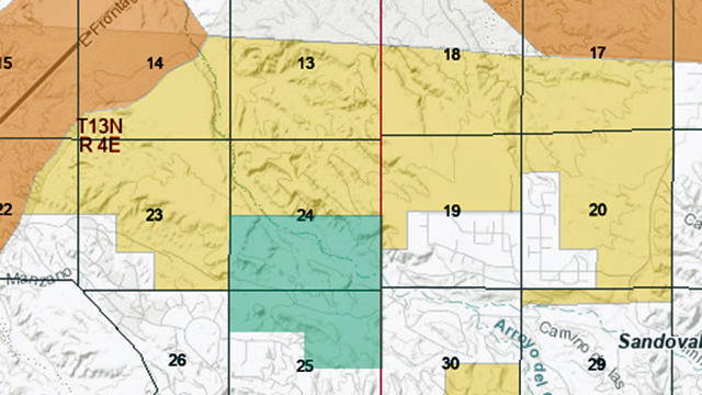
The open space has several access points; this hike uses one near the west edge. From Albuquerque, head north on I-25 and take the US 550 exit (second Bernalillo exit). Turn right as if headed to Old Placitas. A quarter-mile later, turn left to get on the access road that parallels I-25. Head NNE for about 1 1/2 miles, then turn right onto Camino Manzano. On reaching the local homes, turn left onto Santa Ana Loop and follow that around. Turn left onto Cloud View Court and follow that to its end (the last part is unpaved but graveled).
Park at the loop and head northeast until you intercept the two-track in the bottom of the local drainage. Continue upstream (roughly east) along the two-track. At first you’re on BLM land but soon you’ll reach the fence marking the west edge of the open space, Keep going to 35 deg. 20.035 min. N, 106 deg. 28.448 min. W. To your south is a pass between a steep-sided hill (to the right) and a steep-sided ridge (to the left). Head through the pass to 35 deg. 19.863 min. N, 106 deg. 28.454 min. W, then take the path that heads ESE along the south side of the ridge. After a while the path takes a sharp left turn and climbs to the top of the ridge, to an intersection. Take a left and walk WNW along the ridgetop, to the Sacred Spiral at 35 deg. 19.881 min. N, 106 deg. 28.340 min. W.
A two-person bench nearby provides a place to sit and contemplate the spiral and the countryside beyond. Once you’re sufficiently irradiated with astral forces, backtrack to the intersection, take a left, and head north off the ridge until you reconnect with the two-track. Head downstream until you’re back at your car.
This is open, easy country, and you don’t need such detailed instructions—all you need to know is where the spiral is. It’s on Google Maps, if you use that. It would be easy to pick a different route to and from the spiral. And the news gets better. You can wander onto the BLM land that adjoins the open space. Just be sure to turn around where that land stops.