Mano Trail loop hike in the southern Sandias

Another hike based on one in Mike Coltrin’s excellent Sandia Mountain Hiking Guide. This isn’t an official Forest Service trail; in places it rises or drops steeply or fades out. Thus, I don’t recommend it for beginning hikers or small children. Even experienced hikers will find a GPS and waypoints helpful for staying on route.
Coltrin recommends the Mano Trail for fall through spring hikes, but if there’s snow the steeper portions will be treacherous. Also, the hike is exposed to the wind. Save this one for a mild day.
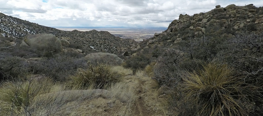
During the hike you’ll encounter the decomposed granite that characterizes trails on the west slopes of the Sandias. When you’re heading downhill, especially, the granite gravel can feel like ball bearings under your feet. I found it very comforting to have both hiking poles deployed as I did the downhill sections of this hike.
To start the hike, drive to the east end of Indian School Road NE in Albuquerque and park in the big lot at 35 deg. 9.45 min. N, 106 deg. 28.818 min. W. Head east on the Embudo Trail. Three hundred meters in (at 35 deg. 5.909 min. N, 106 deg. 28.610 min. W), turn right (south) off that trail, cross the wash, and follow the path ESE to the south end of the flood control dam. Once there you can head straight up, but it’s easier to bear a little to your right. Similarly, you can plunge straight down the far side of the dam but the path that heads off to your right makes the same drop more gently.

By this point you can see your initial goal, which is a triple power pole south and a little east of you. There are several ways to get to the triple pole, thanks to the spider web of trails in the Sandia foothills. My recommendation: as soon as you’re in the bottom of the local valley, take the first obvious path southward. This path quickly becomes a sandy arroyo bottom, which you follow upstream. Proceed to 35 deg. 5.576 min. N, 106 deg. 28.435 min. W and then make a left (southeast) turn to reach the triple power pole. Continue on the path that leads uphill and roughly east from there.
At 35 deg. 5.500 min. N, 106 deg. 28.232 min. W, you come to a T. Turn right (south) and head into a small hanging canyon, where the trail bends east. At 35 deg. 5.430 min. N, 106 deg. 28.160 min. W, turn left off the obvious trail and scramble upward a few meters through the rocks. (Look for scuffed earth between the rocks, indicating where others have gone before you. If you cross the bottom of the small hanging canyon, you're past the turnoff.) Once you turn off, you’ll quickly encounter a path that heads up to the saddle to the northeast. At the saddle the trail turns southeast, up the ridgeline.

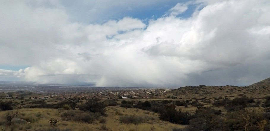
The steep climb suddenly gives way to a ramble through gentle terrain. Continue south to the crest of a broad saddle, at 35 deg. 5.220 min. N, 106 deg. 27.966 min. W. There, a cross-path shows where people have gone exploring. The path to the west takes you among giant boulders and to great views of Albuquerque. If you want a short (if steep) hike that takes half a day, this area is a good destination for an in-and-out hike.
To do the hike as a loop, continue on the path south from the crest of the broad saddle. As the trail drops off the saddle, it curls east a little, and even trends up for a bit, before dropping into the local canyon bottom. If you lose the path among the rocks, check carefully and you should be able to find it again. Coltrin’s MNOWP5 through MNOWP7 will help you stay on the correct route.
Once the path reaches the canyon bottom, it climbs the ridge beyond. At 35 deg. 4.888 min. N, 106 deg. 2.986 min. W, the path reaches a T. Turn right and follow this path westward down the ridge. At 35 deg. 5.007 N, 106 deg. 28.388 min. W, take the right fork in the path. Continue westward down the ridge until you reach a quadruple power pole. Go 20 meters past the pole and take a hard right. You’ll immediately encounter a fork in the new trail; take the right fork. At 35 deg. 5.110 min. N, 106 deg. 28.552 min. W you’ll be off the ridge and back on the spider web of trails at the western base of the Sandias. Take these trails northward, to where you parked.