Hay Canyon Loop Hike in the Jemez Mountains
If you’re looking for a pleasant hike in the Jemez Mountains, this one is hard to beat. The scenery is lovely, the walking is easy, and the hike is only about 5 1/2 miles long. None of the trails involved is numbered or maintained, but they’re well enough used (including by cows) to remain visible. The entire hike is above 8000 feet so it should be pleasantly cool on all but the most scorching days. For a video preview of the hike, click here.
The route is modified from one on the extensive and excellent ASCHG web site. In the original version you descend a shady unnamed canyon in the morning and hike up sunny Hay Canyon in the afternoon. I reversed the direction of travel so you’re in the sun in the cool of the morning and mostly in shade as the day grows warm. Also, my jump-off point differs from that for the ASCHG hike.
From the north end of Albuquerque it’s about 2 1/4 hours to the trailhead. Once at San Ysidro head north on NM 4, through Jemez Springs, turning left on NM 126 at La Cueva. At 35 deg. 53.479 min. N, 106 deg. 40.070 min W, turn right onto Forest Road (FR) 144. This is unpaved and in places rocky and rutted, so a high-clearance vehicle is a must. FR 144 meanders along a ridgeline; as side roads appear, continue northward on the most prominent road. At 35 deg. 57.034 min. N, 106 deg. 38.561 min. W, an old road in poor condition takes off to the left. Make note of this road—it’s the start of the hike—but continue another 50 meters and use a turnoff to the right to park.

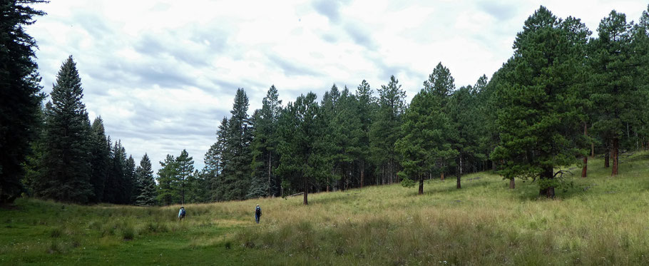
Once out of your car, you can either backtrack to the side road you just passed or walk due west to intersect that road. Either way, follow the road up over a low ridge and down into Hay Canyon. At 35 deg. 57.285 min. N, 106 deg. 38.763 min. W (BEGIN LOOP), turn left (southwest) and follow the trail along the ghostly trace of an old road down the canyon bottom. As you do, you’ll find yourself in a mountain meadow with spruce-fir forest on the shadier slope to your left and ponderosas on the sunnier slope to your right. On both slopes, patches of aspen are mixed in.
About 35 deg. 56.831 min. N, 106 deg. 39.754 min. W, the meadow pinches out. Some 300 meters farther downstream, the drainage in Hay Canyon plunges off a cliff. If you’re careful to stay on the trail, you’ll find yourself on a bench on the north side of the plunging canyon. If unsure of the trail, head to 35 deg. 56.792 min. N, 106 deg. 40.003 min W. Near there you’ll see the first of several overlooks of the Rio Cebolla. Keep on the trail and the bench as both curl to the right (north).

Starting about now, and for much of the rest of the hike, you’ll repeatedly encounter trees that have fallen across the trail. However, they’re only a minor nuisance. Once past the viewpoints, the trail continues on the bench, through woods, to the unnamed small canyon north of Hay Canyon. At 35 deg. 57.239 min. N, 106 deg. 40.045 min. W, the path reaches the bottom of the unnamed side canyon and turns upstream (mostly east). The easy walk up the canyon bottom alternates between meadows (in August 2019, many of them choked with ferns) and woods.
At 35 deg. 57.327 min. N, 106 deg. 39.839 min. W, an old road bed (no longer passable except on foot) leaves and parallels the canyon bottom. You don’t have to follow the road bed from the beginning—you can continue up the canyon bottom for hundreds of meters if you prefer—but eventually you’ll have to get on the road. At 35 deg. 57.415 min. N, 106 deg. 39.057 min. W, the road bed curls right (SE) and climbs out of the unnamed canyon. Once it crosses a low ridgeline, the road curls left (NE) and drops into upper Hay Canyon. About 35 deg. 57.464 min. N, 106 deg. 38.697 min W, as the road nears the bottom of Hay Canyon, drop off the road and walk down Hay Canyon to BEGIN LOOP. You have now completed the loop portion of the hike. From there, follow the old road you came in on, south and southeastward out of Hay Canyon, over the low ridge and back to your vehicle.
