Notes on the Ellis Trail and a Power Line Route in the Sandia Mountains

The Ellis Trail isn't one of my favorites. On the plus side, there's a signed turnoff and a parking lot with pit toilets (turn at 35 deg. 12.563 min. N, 106 deg. 26.473 min. W). On the minus side, the trail heads north along a fire break and you're hiking in the sun. In cool weather that can be a plus, but during the summer the 10K and Service Trails provide shadier alternatives. When heat is a concern, one option is to hike north along the Ellis Trail early in the morning and return via the 10K or Service Trails.
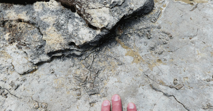
If you do hike the Ellis Trail, be sure to stop at 35 deg. 13.030 min. N, 106 deg. 26.735 min. W and check out the boulders with multiple crinoids.
Suppose you do the Ellis Trail as part of a loop involving the 10K or Service Trail or even the North Crest Trail—going north on one trail and returning on another. How do you get back to your car? One answer is to cross the Crest Highway on your return trip and use the numbered trail system. For example, at the south end of the Survey Trail you can use the Switchback Trail (271) to descend to the service road (488), which will take you back to the Ellis Trail parking area. Or if you went north on the 10K Trail, you can continue your descent to that trailhead via the Challenge Trail (233). Map 21 on Page 168 of Mike Coltrin's book shows what I'm talking about.
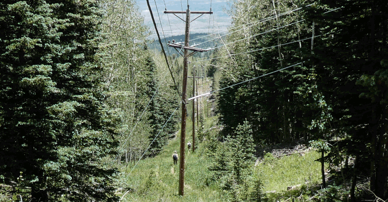
But let's say you want to return to your outbound trail by a less roundabout route. You hiked out the 10K Trail, for example, and are coming back on the Ellis or Survey or Crest Trail. There is a way to do that, besides bushwhacking or following the highway. Namely, follow the power line that serves Sandia Crest. To prevent fires the right-of-way is kept mostly clear, and you can usually fined a path of sorts. The route lacks the aesthetic appeal of the established trails south of the highway, but it is direct. In fact, it's brutally direct. If you design a hike involving the power line as a connector route, it's good to be hiking downhill as you follow the line. Also, I do not recommend this route for anything downhill from the 10K Trail.