El Cajete via Redondo Meadows

The Jemez Mountains have been hit by one wildfire after another, and you'll see evidence of those fires during the hike. Most of the route is pristine, however, and the areas that have burned are re-greening rapidly. The Cajete Fire of 2017 was well to the south.
This is just one of many hiking options in the Valles Caldera National Preserve. To learn about the local hiking guide, check out this web site.
The VCNP is managed by the National Park Service. Please check the web site for the latest guidelines before hiking. As of this writing (July 2017), day hikers who park outside the preserve and walk in don't need a permit.
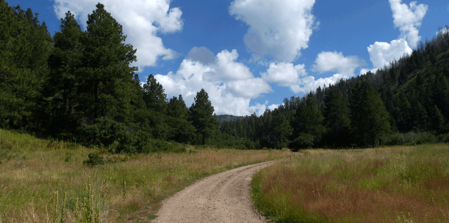
"Cajete" means "shallow bowl," and the simile is an apt one. El Cajete is a meadow in a natural depression, surrounded by low hills. Reaching the meadow involves hiking along maintained dirt roads, so despite the elevation gain (roughly 1000 feet), this hike is less about challenging yourself and more about enjoying the beauty of the Jemez Mountains. Because vehicle access is so tightly controlled, during your hike you may not encounter a vehicle (or another human being) all day.
After looking at a map you might be tempted to park at the Banco Bonito reception area and hike east to reach El Cajete (the VC07 road). I recommend that instead you park next to Redondo Creek, at the Valles Caldera boundary, and hike to El Cajete via Redondo Meadows.
To reach the starting point, take NM 4 north from San Ysidro, through Jemez Springs and past La Cueva. After you enter the big rightward curve, turn left onto a dirt road at 35 deg. 52.515 min. N, 106 deg. 37.687 min. W. In about 670 meters you'll reach the locked gate to the preserve. Parking right at the gate isn't a good idea when it's rainy; the wide spot there is at stream level, so subject to flash flooding. To avoid that risk, consider the somewhat-wide spot in the road at 35 deg. 52.409 min. N, 106 deg. 37.416 min. W. If you're careful, there's room for a car to park without blocking the road.
Begin the hike by crawling under the gate (35 deg. 52.370 min. N, 106 deg. 37.278 min. W; 7840 feet) and continuing up the well-groomed dirt road, more or less southeast, paralleling Redondo Creek.
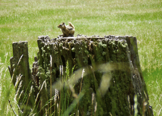
When you reach Redondo Meadows, the active road cuts east across the flats. Ignore the road that branches left (northeast) and continue to the east side of the meadows. You'll pass blinds used in a long-term scientific study of the local prairie dogs. (As of 2017 the colony had almost been wiped out by the plague.)
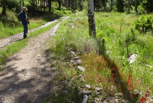
Shortly after rock-hopping across a tiny creek (if it's running), at 35 deg. 51.610 min. N, 106 deg. 36.077 min. W, take the road to the right (south). This road soon bends eastward and skirts the south edge of Redondo Peak, entering a side valley and following it upstream. The road is still easy walking but it's a steady climb. In July 2017 there was water trickling along one segment of the road; I was able to harvest (and filter) water on the return leg of the hike. It's not a dependable source, however.
As you keep climbing, you'll enter a burn area. Some of the aspen saplings are already head-high, so in a few years there should be a healthy grove here. About 35 deg. 50.922 min. N, 106 deg. 33.897 min. N, you reach a shade tree at the high point of the hike (8900 feet). Soon afterwards the road curves southward and drops into El Cajete, the closed basin that's the goal of this hike. During the descent you're back into unburned forest.
At 35 deg. 50.441 min. N, 106 deg. 33.531 min. W ("Begin Loop"), the road forks. Continue on either fork to reach the meadow at El Cajete. I recommend the the right fork, which in about 140 meters takes you to the edge of the meadow. You can have lunch among the evergreens and aspens at the edge of the meadow, then retrace your steps to your car. Done this way, the hike is roughly 6 miles (9 1/2 km) long.

For a longer, more energetic hike, you can do a loop around El Cajete. This adds 3 1/2 miles (5 1/2 km) to the hike, for a total hike of about 9 1/2 miles (15 km).
I'll assume that you're traveling counterclockwise. Take the right fork at "Begin Loop" and skirt the northwest edge of the meadow. At 35 deg. 50.151 min. N, 106 deg. 34.021 min. W, make a sharp left turn. (If you instead head west, the road leads to the Banco Bonito entrance.) The road you're now on angles up and away from the meadow, to the rim of the bowl. From there the road drops into a pretty little valley.

Near the low point of the loop (about 200 feet lower than the floor of El Cajete), at 35 deg. 49.800 min. N, 106 deg. 33.599 min. W, a road and unobtrusive power line join the route from the west. The loop hike continues east but then bends north, following the valley, road, and power line upstream. As you approach 35 deg. 50.065 min. N, 106 deg. 32.777 min. W, you'll see a road in the trees to your left. Take that sharp left turn and follow the road as it climbs steeply, zigzagging west. The road crests at 35 deg. 50.103 min. N, 106 deg. 33.049 min. W, then bends north and drops into El Cajete. Follow the road past another burn area until you find yourself back at "Begin Loop." From there, retrace your steps through Redondo Meadows and back to your car.

For a very easy alternative, hike to Redondo Meadows as described above, but turn left (northeast) at 35 deg. 51.623 min. N, 106 deg. 36.243 min. W. Follow this road up Redondo Creek, alternating between forest cover and mountain meadows. Along the way you'll see remnants of a Unocal (Union 76) thermal energy exploration project. Go as far as you wish, then stop for lunch. The ramble up the valley involves a gentle elevation gain, and the walk back to your car will be downhill all the way. In August 2015 and again in August 2017, Redondo Creek was burbling merrily along the route, but that was during wet summers; don't count on the stream being there in dry weather.