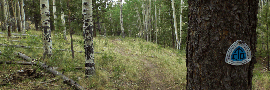
A bit of the CDT on Mount Taylor
On July 4 2018, most of the local national forests were closed and Albuquerque was blazing hot, so we escaped to 9500 feet on Mount Taylor. We even had cloud cover; at mid-afternoon the local temperature was in the high sixties. Our in-and-out hike used a bit of the Continental Divide Trail where the walking is mostly rock-free and there are no serious ups and downs. Part of the access route is unpaved, but the entire access route is suitable for ordinary passenger vehicles. As in so much of New Mexico’s back country, cell coverage is lacking.
From Albuquerque, drive west to Grants and get off at the NM 117 exit. Head north (right). The road curves left (northwest) and become Santa Fe Avenue. At First Street (NM 547), turn right (NE). At Roosevelt Avenue, 0.9 mile later, turn right (east). At Lobo Canyon Road, 0.4 mile later, turn left and reset your trip meter. Follow Lobo Canyon Road (NM 547) northeast about 15.0 miles, to 35 deg. 16.640 min. N, 107 deg. 38.923 min. W. Turn right (SW) onto FR 453 (La Mosca Lookout Road). The turnoff is marked with signs.
At 35 deg. 15.791 min. N, 107 deg. 37.695 min. W, turn right off the road and park near the pit toilets. The turnoff is difficult to miss because 60 meters earlier, there’s a shelter on the left side of the road. After you park, backtrack 90 meters along FR 453 to where the CDT crosses the road. The crossing, at 35 deg. 15.793 min. N, 107 deg. 37.759 min. W, is marked by robust cairns. This guide is actually for two hikes, because once at the road crossing you can head either north or south along the CDT. We chose to head south.
At times, the local CDT follows an old graded road through the woods. At times, the CDT consists of a footpath that parallels the road, sometimes just a few feet away. As of July 2018 the initial section of the route we took was indicated by blue blazes, but then nailed-on CDT “badges” were common. The route is also marked by more of the robust cairns.
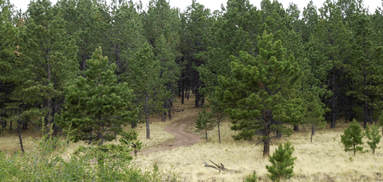
Despite the elevation, the dominant plant cover is open Ponderosa woodland, with occasional refreshing stands of aspen. A few hundred meters from the parking area, you’ll pass left of Rock Tank. If you stay on the road, farther out you’ll pass a side valley (to your left) containing Cienega Spring. In July 2018 both were just muddy spots, so treat this as a dry hike.
At 35 deg. 15.197 min. N, 107 deg. 38.020 min. W, the CDT turns right off the graded road for a stretch of foot trail that gets you out of sight of the road. If you miss the turnoff, don’t worry; the road and foot trail rejoin soon enough. Keep hiking until you’re ready to find a lunch spot, then retrace your steps to the car to complete the hike.
