Navajo Draw

A pleasant ramble in a bit of readily accessible countryside, just off the west edge of Rio Rancho’s West Mesa. By the time you’re done, you may have hiked three or four miles in rolling, juniper-dotted terrain. Final access is on dirt roads, so a high-clearance vehicle is best. Also, your explorations will take you across or along arroyo bottoms, so not a good hike during a storm.
In Rio Rancho, take Northern Boulevard west. The streets at the west end of the West Mesa have no street signs, so you’ll need a GPS to find the start of the hike. Turn right (NW) on Encino Rd.
(just before the large water tank), at 35 deg. 16.459 min. N, 106 deg. 48.145 min. W. Head northwest on Encino and turn left at 35 deg. 21.068 min. N, 106 deg. 51.216 min. W.
Follow that road down off the mesa. At 35 deg. 21.278 min. N, 106 deg. 52.202 min. W, pull off to the right and park near the plastic stock tank.

Begin the hike by walking 0.9 mile west along the road, to a locked gate in a north-south fence. Beyond the fence is private land that’s posted against trespassers. Staying on the near side of
the fence, turn south (left). At first you’ll be on a two-track that takes you to the edge of Navajo Draw. There you’ll find broken glass and other debris from some yahoo’s impromptu shooting
range. Just beyond the mess the two-track becomes a series of sketchy paths. Follow one of those if you wish, or drop into the wash to your left and follow that for a while. Either way, continue
south to the stream bed of Navajo Draw, at 35 deg. 20.700 min. N, 106 deg. 53.126 min. W. You can now turn east to explore up Navajo Draw and its tributaries. To extend the hike, you
can instead follow the fence farther south, to 35 deg. 20.528 min. N, 106 deg. 53.126 min. W, where you’ll be in the bed of a tributary wash that you can follow upstream.
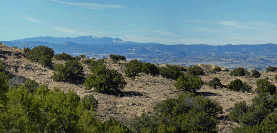
Upper Navajo Draw is carved out of the poorly consolidated Santa Fe formation, which erodes into rolling but fairly gentle terrain. Much of that terrain is blanketed by sand, and the arroyo bottoms are gradual and sandy. It’s mostly easy walking, so a great chance to explore free-form.
When you’re ready to leave, at 35 deg. 20.972 min. N, 106 deg. 52.526 min W you’ll encounter a bike trail heading out of the draw. At 35 deg. 21.202 min. N, 106 deg. 52.470 min. W, the bike trail tops out, 400 meters west of where you parked. Follow the bike trail back toward your vehicle. As of December 2015 the bike trail rejoined the road at 35 deg. 21.261 min. N, 106 deg. 52.322 min. W, but you could continue along the rim of Navajo Draw until you’re nearer your car.
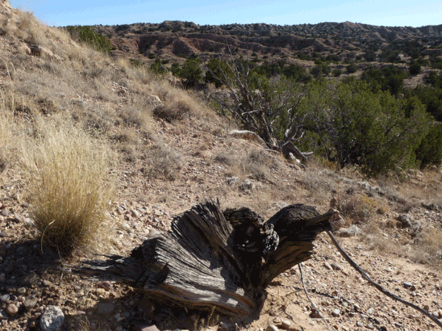
A couple more comments on this hike. If you’re easily distracted by pretty pebbles (as I am), you’ll like wandering in this area. The pebbles are weathering out of the Santa Fe formation, after being transported from the Rockies by the Rio Grande ages ago. Also, keep an eye out for axe-cut limbs on still-living junipers and axe marks on stumps. A few generations ago, someone foraged these slopes for firewood.