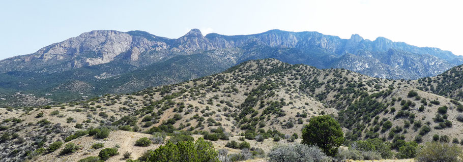
Juan Tabo Canyon in the Sandia Mountains
This hike includes an easy exploration of Juan Tabo Canyon and a strenuous loop option. Given the elevation and limited tree cover, it’s best as a cool weather hike. Given the arroyo crossings and arroyo-bottom travel, save the hike for dry weather. Also, don’t count on helpful trail signs like those elsewhere in the Sandias. If you encounter a fence during your wanderings, you’ve reached the edge of the national forest and shouldn’t go any farther.
The trailhead is off Forest Road 333, which heads north from the east-west portion of Tramway Boulevard (at the north end of Albuquerque). Park in the small area on the left at 35 deg. 13.003 min. N, 106 deg. 29.246 min. W (6710 feet). (If this small area is full, park a quarter-mile farther on. If using one of the backup parking areas, head west through the trees to intercept the trail.)
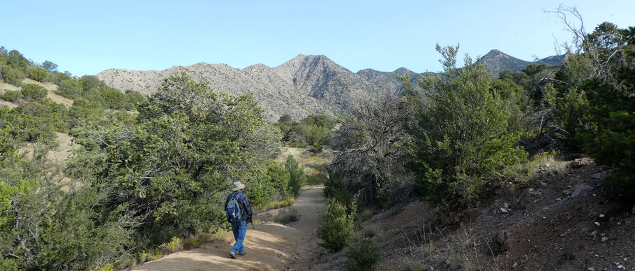
Forest Trail 2 starts at the north end of the recommended parking area and wanders north and west, over a low rise and down into a side drainage of Juan Tabo Canyon. The trail is a former road so has a gentle grade and is easy walking, including for kids, dogs, and horses. Beware of the many gifts left behind by irresponsible dog owners.
At 35 deg. 13.310 min. N, 106 deg. 29.444 min. W, Forest Trail 2 drops into a sandy arroyo bottom. To explore farther northward, head about 40 meters up the arroyo bottom (a right turn) and then turn north (left) to leave the arroyo. For your first visit I recommend walking down the arroyo (a left turn). According to Mike Coltrin’s excellent guide, this is the Sandy Arroyo Trail (No. 2B).
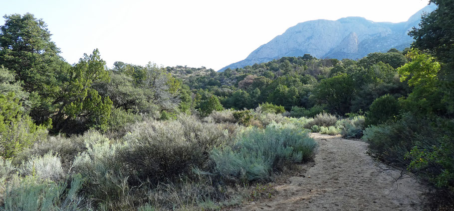
At 35 deg. 13.333 min. N, 106 deg. 29.704 min. W, a 200 m long path leaves the arroyo and takes you through a low spot to Juan Tabo Canyon’s stem drainage. Or you can continue about 300 m down the side drainage and reach the stem drainage that way. Once there you can explore up and down Juan Tabo Canyon’s main drainage (nominally along Forest Trail 4). The downstream portion of the canyon narrows, and soon you’ll need to pick your way through or around dense patches of canyon-bottom vegetation.
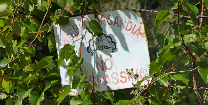
At 35 deg. 12.932 min. N, 106 deg. 30.186 min. W, you’ll encounter the boundary fence for Sandia Pueblo. Time to turn around. At this lowest possible point in the hike you’re at 6190 feet, or 520 feet below where you parked. Given the gentle gradients involved, your legs aren’t likely to notice the change in elevation. To keep it an easy ramble, explore Juan Tabo Canyon as much as you wish, then retrace your steps along Forest Trail 2 to your car.
The rest of this page describes a way to turn your outing into a loop hike. The route briefly overlaps with the loop hike on Pages 173–175 of Mike Coltrin's guide. The option I describe provides great views but involves hill climbs, and is for experienced hikers only. The paths involved are all informal and some are steep and slippery. When doing this option I was glad to have two hiking poles for maximum stability.
Begin the hike as described earlier. Once you reach Juan Tabo Canyon, head downstream. As you approach 35 deg. 13.080 min. N, 106 deg. 30.026 min. W you’ll encounter a dense patch of trees and brush in a bend of the canyon bottom. Skirt the vegetation to the left (southeast side), using a faint path, until you reach the waypoint just provided (≈ Coltrin's BNDTR4). There, a second faint path branches off the first one and zigzags upslope. Follow the second path out of the canyon bottom and mostly south, to a junction at 35 deg. 12.890 min. N, 106 deg. 30.018 min. W (≈ Coltrin's BNDWP6).
The next part of the hike follows part of Coltrin's loop hike, but heading in the opposite direction. At the junction, turn
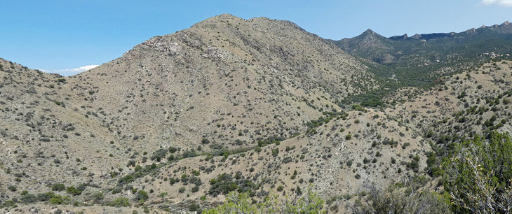
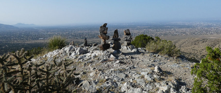
left (NNE) and head uphill until you pass to the right of a local high point at 35 deg. 12.979 min. N, 106 deg. 29.982 min. W (≈ Coltrin's BNDWP5). The view from that local high point is the one you see below.
At the local high point the trail turns NE and drops a bit, to a different trail junction at 35 deg. 13.049 min. N, 106 deg. 29.841 min. W (≈ Coltrin's BNDWP4). At the junction, step a few meters to the north to enjoy the view. Coltrin's loop hike comes up the path to the right and continues the way you just came. However, your task is to climb the ridge directly ahead. The unofficial path up that ridge soon includes a 50 meter long section that goes straight up and down, with lots of slippery gravel. If it bothers you as much as it bothered me, try cutting through the trees to the right, at an upward angle, until you reach a ridge line. Then follow that ridgeline upward until you get to the top of the bad section. From there, the path continues upward to the highest point of the hike (at 35 deg. 12.987 min. N, 106 deg. 29.552 min. W; 7040 feet).
You have now climbed 720 feet from the canyon bottom and have a 330 foot drop back to your car. Proceed down the path that heads down the ridge line to the north. There are two ways to complete the hike and I'll present both, but I recommend the second option.
The first, less desirable option is to follow the ridge line all the way downward. As you continue to drop, that ridge line bends east and suddenly becomes much steeper. At that point the informal path gets steep and slippery and is no fun. You’ll come out on Forest Trail 2 at 35 deg. 13.082 min. N, 106 deg. 29.319 min. W, completing your loop. Take a right turn and continue 200 meters along the trail to reach your car.
Here's what I recommend instead. Begin by following the path down the ridge line to the north, as in the first option, but turn left off that path at 35 deg. 13.070 min. N, 106 deg. 29.493 min. W. There, a faint path leads north and west and downward. The junction of the two trails is marked by a cairn, but it's small and easy to overlook. At 35 deg. 13.105 min. N, 106 deg. 29.541 min. W, you'll reach a saddle. You can explore farther out on the local ridgeline, but to get back to your car take the path that heads east and downward from the saddle. You'll come out on Forest Trail 2 at 35 deg. 13.131 min. N, 106 deg. 29.346 min. W, completing your loop. Take a right turn and continue 300 meters along the trail to reach your car.