Embudo Trail in the Sandia Mountains

From the trailhead at the mouth of Embudo Canyon, you can poke around at the base of the Sandia Mountains or head all the way to their crest. From Tramway Boulevard in Albuquerque, turn east onto Indian School Road and continue to the big parking lot at the end of the road, at 35 deg. 5.949 min. N, 106 deg. 28.817 min. W. Head east and upstream, past a water tank and flood control dam.
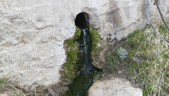
At 35 deg. 5.941 min. N, 106 deg. 28.288 min. W, you’ll enter the Sandia Mountain Wilderness. From there, head ESE on an obvious trail. As you approach the narrows of Embudo Canyon, stay slightly left (north) of the stream bed. At 35 deg. 5.800 min. N, 106 deg. 27.817 min. W, an old dam (now filled with sediment) spans the canyon bottom at Embudo Spring. The spring only flows after long spells of wet weather. If you encounter water, be sure to purify it before use.
The hike to Embudo Spring and back is a kid-friendly two-mile round trip. To continue beyond the dam, clamber up at the dam’s left (north) end. Once above the dam you’ll face about 200 meters of walking and scrambling among boulders, and it’s not always clear which path to follow. More often than not, the correct solution is to stay high and to the left—but one way or another, with a little backtracking, you’ll make it through. This is not a toddler-friendly section, however.
As the narrows begin to open up, the path drops to the stream bed and enters a pleasant grove of trees. About 100 meters past the trees, at 35 deg. 5.771 min. N, 106 deg. 27.564 min. W, follow the path as it turns right (southeast) and heads up a side drainage. About 50 meters up that drainage is the junction with a path that bypasses the narrows. For a change of scenery on the way back out, take that bypass out of the canyon. Once out of the hills you can turn north to rejoin your original route.
But right now let's head deeper into the Sandias. At the junction you can scramble up onto the ridge to your left (northeast), then continue southeast. Or you can continue another 90 meters up the side drainage, then follow the path as it turns left. These two routes rejoin at 35 deg. 5.733 min. N, 106 deg. 27.480 min. W. From there the trail stays south of the main drainage. About a mile past the dam, you’ll find yourself in a large open bowl. I’ll leave you there to explore before having lunch and retracing your steps to the car.

If you wish, you can follow Embudo Trail farther into the Sandias, to Three Gun Spring Trail and to points including South Sandia Peak. If that’s your thing, please check out Mike Coltrin’s Sandia Mountain Hiking Guide for details.